


Council Bluffs’ Hidden Gems: Weekend Drives from the Bluffs to the Loess Hills
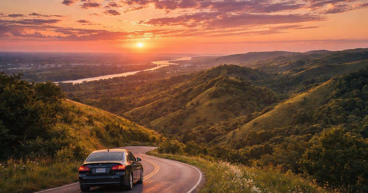
Picture rolling hills that ripple like waves frozen in time, winding roads that reveal new vistas around every bend, and sunsets that paint the prairie sky in shades you didn’t know existed. That’s what awaits just beyond Council Bluffs, where Iowa’s flat expanse gives way to one of North America’s most unusual landscapes. The Loess Hills rise along Iowa’s western edge, offering scenic drives that rival anything you’ll find in more famous destinations.
Why Council Bluffs Is Your Gateway to Iowa’s Best Scenic Drives
We’re fortunate here in Council Bluffs. Our city sits at the perfect crossroads for exploring Iowa’s most dramatic scenery, blending urban convenience with easy access to rural landscapes. Within minutes of leaving the city limits, you’re surrounded by views that make you understand why early pioneers paused here.
The location offers something practical too. You can start your drive after a leisurely breakfast and still explore multiple stops before dinner. The Loess Hills stretch north and south from Council Bluffs, creating options for quick afternoon escapes or full-day adventures. Having reliable transportation matters for these excursions, and if you’re looking to explore our used vehicle inventory, we help ensure everyone in our community can access these natural treasures.
The Loess Hills Scenic Byway: A Drive Unlike Any Other
The 220-mile Loess Hills National Scenic Byway traces one of only two major loess formations in the world. Loess is windblown silt accumulated over thousands of years, creating ridges that tower 200 feet above the surrounding terrain. The result looks more like the Badlands than typical Iowa scenery.
The byway winds through small towns, past working farms, and into state preserves where original prairie ecosystems thrive. Some sections take you along ridge tops with panoramic views. Others dip into valleys where streams cut through the hills. What makes this drive special is how the landscape keeps shifting with the sun’s movement. Spring brings wildflowers carpeting the slopes. Summer turns everything lush. Fall transforms hardwood trees into flame-colored beacons, and winter reveals the hills’ raw contours.
Must-See Viewpoints and State Parks Along the Route
Hitchcock Nature Center, just north of us, offers a 45-foot observation tower providing panoramic views of three states. The trails here range from easy walks to more challenging hikes that reward effort with impressive vistas.
Further north, Preparation Canyon State Park carries fascinating history as the site where a religious group waited for the end of the world in the 1850s. Today it’s peaceful ground for hiking and photography, with wooded ravines contrasting beautifully with open prairie sections.
Waubonsie State Park sits at the southern end and offers some of the most dramatic views in the entire system. The park’s sunset point delivers exactly what you’d expect. The campground makes a solid overnight base for weekend camping trips, with early morning mist in the valleys creating memorable photo opportunities.
Historic Towns and Local Stops Worth Exploring
Small towns scattered along the byway offer more than gas stations and restroom breaks. Places like Missouri Valley, Pisgah, and Mondamin preserve authentic small-town character. These are working communities where local businesses serve real needs.
Missouri Valley makes a logical midway stopping point. The downtown features well-preserved brick buildings from the early 1900s, and local cafes serve home-cooked meals. The community museum offers insights into the region’s history as agricultural centers and railroad stops.
Towns like Tabor carry significant historical weight as Underground Railroad stops and sites that played key roles in events leading up to the Civil War. Walking these streets adds context that visitors often overlook when sticking to major highways.
Hidden Gem Drives Beyond the Main Byway
The official byway gets most of the attention, but some of the best drives happen on smaller roads branching off the main route. These hidden options offer solitude and personal discoveries for anyone searching for scenic drives near Council Bluffs, IA.
The Southern Loop Through Waubonsie Country
Starting from Waubonsie State Park, a loop through Fremont County takes you through unspoiled Loess Hills terrain. County roads like Oxbow Avenue and Frontier Road wind through working farmland where hills rise and fall like ocean swells. You’ll pass tiny communities where a single church and grain elevator can make up the entire town center.
This route requires more navigation attention since GPS can get confused on rural roads, but that’s part of the charm. The lack of crowds means you can stop anywhere that catches your eye. Spring wildflowers bloom in relative obscurity, creating displays that would draw crowds anywhere more accessible.
The southern loop also offers wildlife viewing opportunities. White-tailed deer are common near dawn and dusk. Hawks and eagles patrol ridgelines. If you’re quiet and observant, you might spot wild turkeys or coyotes in their natural habitat.
Northern Routes Toward the Missouri Valley
Heading north from Council Bluffs, several county roads parallel the main byway while offering different perspectives. Highway 183 north of Missouri Valley provides ridge-top driving with sustained views. The road here feels more remote, with longer stretches between towns.
Northern routes connect to places like the Loess Hills State Forest, where trails follow paths early explorers used when this was frontier territory. The forest preserves old-growth areas showing what the region looked like before settlement. Small museums and historical markers tell stories about Native American history, pioneer settlement, and the challenges of farming this unique terrain.
Best Times to Experience These Scenic Routes
Every season transforms the Loess Hills into something different. The landscape never stops being beautiful, but it definitely has moods that shift with the calendar.
Spring and Fall Color Seasons
Spring arrives gradually, starting with subtle greens in valleys before climbing ridgetops over several weeks. Wildflowers follow similar patterns, creating waves of color that move up slopes as temperatures warm. By late April and early May, the hills are alive with blooms. Pasque flowers appear first, followed by prairie smoke and wild indigo.
Fall brings drama that draws photographers from across the region. Oak trees turn rich reds and oranges that glow in afternoon light. Sumac adds crimson splashes. Golden prairie grasses create movement and texture. Peak color usually hits mid-October, though timing varies each year. The weather during both seasons tends toward mild temperatures, making drives comfortable without summer heat or winter cold extremes.
Summer Adventures and Winter Considerations
Summer turns the hills lush and green, with wildflowers blooming through July and August. Longer days mean you can start drives later or stretch them into evening. Heat can be a factor in July, but elevation changes often bring cooling breezes. Summer is also when local festivals and farmers markets are most active.
Winter offers stark beauty. Snow highlights the hills’ contours in ways that vegetation obscures. Wildlife becomes easier to spot against white backgrounds. However, some county roads may not be cleared promptly after storms, and ice on steep grades requires caution.
Where to Stop for Local Food and Refreshments
Missouri Valley offers several solid dining options around the town square. Family-run restaurants serve breakfast all day and lunch specials reflecting comfort food traditions. This is where you’ll overhear conversations about crop yields and high school sports.
Smaller towns like Pisgah and Moorhead may have only one or two eating options, but they’re memorable for authenticity. Don’t overlook farm stands and small markets along the route, especially during growing season. Fresh produce, local honey, and homemade jams make great picnic additions at scenic overlooks.
Essential Tips for a Memorable Loess Hills Drive
Start with a full gas tank, as stations can be spaced far apart. Pack water and snacks since businesses in small towns may have limited hours. A paper map or downloaded offline navigation provides backup if cell service gets spotty.
Timing drives around meals in larger towns makes sense. If planning to hike at state parks or nature centers, bring appropriate footwear. Some trails involve steep climbs on loose soil. Binoculars enhance wildlife watching, though sometimes simply sitting and looking is the best approach.
Respect private property along these routes. Most land you’ll see consists of working farms and ranches. The public overlooks and parks provide plenty of access. Check road conditions before heading out, especially on county roads after storms. Having flexibility helps you adapt to unexpected discoveries.
Plan Your Weekend Adventure
The scenic drives around Council Bluffs prove you don’t need mountain ranges or ocean coastlines to experience natural beauty that stays with you. The Loess Hills create landscapes that surprise people expecting Iowa to be uniformly flat. Whether you spend a few hours on a Sunday afternoon or dedicate an entire weekend to exploring every side road and scenic stop, the hills deliver experiences worth the time.
Having dependable transportation makes these adventures accessible. When you’re ready to hit the road in a reliable vehicle, CarHop of Council Bluffs offers budget-friendly options designed to help local drivers stay on the move. You can browse our used vehicles in Council Bluffs or learn more about buy here pay here options in Council Bluffs before planning your next outing.
The Loess Hills have been here for thousands of years, shaped by wind and time into something remarkable. The question is whether you’ll keep driving past on the interstate or take the exit that leads to roads less traveled and views that remind you why getting out and exploring still matters. When you’re ready to start your next adventure, visit CarHop of Council Bluffs to explore your local options.
FAQs
What are the best scenic drives near Council Bluffs, IA?
The best-known scenic drive near Council Bluffs is the Loess Hills National Scenic Byway, which runs along western Iowa and showcases rolling ridgelines, prairie views, small historic towns, and multiple state parks. Smaller county road loops near Waubonsie State Park and north toward Missouri Valley also offer beautiful, less-traveled alternatives.
How long does it take to drive the Loess Hills Scenic Byway?
The full Loess Hills Scenic Byway stretches roughly 220 miles, so driving the entire route can take a full day or longer depending on how often you stop. From Council Bluffs, though, you can easily enjoy a shorter afternoon drive by choosing one section and visiting a few scenic overlooks, parks, or small towns along the way.
When is the best time of year to explore the Loess Hills?
Spring and fall are often the most popular seasons. Spring brings wildflowers and fresh green hillsides, while fall delivers colorful foliage and crisp, comfortable weather. Summer is great for longer daylight and local events, while winter offers dramatic views if road conditions are safe.
Are there parks and overlooks near Council Bluffs worth stopping at?
Yes. Hitchcock Nature Center, Preparation Canyon State Park, and Waubonsie State Park are among the top stops for views, hiking, photography, and wildlife watching. Each offers a different experience, from observation towers and wooded ravines to wide-open prairie overlooks and memorable sunsets.
What should I bring for a scenic drive through the Loess Hills?
Bring water, snacks, a charged phone, and a backup map or offline navigation. It also helps to start with a full tank of gas, wear comfortable shoes if you plan to hike, and pack binoculars or a camera if you want to enjoy wildlife and long-distance views along the route.
0 comment(s) so far on Council Bluffs’ Hidden Gems: Weekend Drives from the Bluffs to the Loess Hills